Footpath Assessment

The National Park checks and assesses all the footpaths and bridleways on a rolling programme. This year eleven of the sixteen paths in the two parishes of Throwleigh and Gidleigh came up for assessment. Looking on the bright side it will mean there won’t be many to do next year!

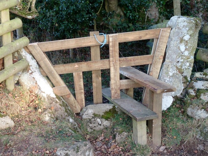
Every gate, bridge, sign, direction marker and stile is checked to see first of all that it is still there and then to check its condition. Obstructions to the route, vegetation growth from above, from the sides and from the ground, if severe enough cause the route to fail the assessment, in which case fairly urgent action will be taken to remedy the situation. It’s a matter of pride to each Voluntary Warden that no path within their parishes fails the assessment!

When a finger board waymarker comes to the end of its life it is replaced. The old signs tell you where they go, for example “Public Footpath to East Week”. Due to money saving measures, such signs are now replaced with “Public Footpath”, or just “Path”.

Over the last few days there have been strong winds and the first significant rain of the Autumn. Today, October the 14th, the river levels will begin to fall allowing the migratory salmon and sea trout to make their way upriver. There should be many salmon making this journey in the next week, it will be one of the first chances they’ve had to do so. In previous years it’s been possible to see over 30 fish make the jump at one of the salmon “ladders” in 10 minutes. The weir 800 metres down river of Mill End on the Teign attracts quite a few people to see this annual event, there’s much cheering and clapping when a particularly big fish makes the jump.


The Hobby

Monday July 16th 2018

After the hot sunny weekend when lots of people visited Shilley pool, I checked the area for litter and signs of BBQs that had been left. Happily, there were none.

On my way up to Cosdon, a Hobby flew past about 20m away. Someone once told me that if you see an impossibly big swift, it’s a Hobby. They are rare summer visitors, but this one was the third I’ve seen this year. It is a wonderful falcon, not dissimilar to a Peregrine, but a little more slender. They are fast enough to catch swallows and martins,  and will take dragonflies when hunting near water.

The inventor of Subbuteo, the table football game, was a keen ornithologist. The Patent Office refused him permission to call the game Hobby as it was already in use.

The name he then chose comes from the Latin name for the Hobby;   falco subuteo.hobby3

Mid summer

The beginning of July marks the start of the strimming season for Dartmoor NP volunteers. This may seem late, bracken is fully grown and the wild grasses are tall and yellowing. There are still fledglings emerging from nests and I guess this is the reason for the late start.

For the first time I heard Nightjars in Throwleigh woods. There are at least two birds, possibly four. They are active at night as the name implies and sleep during the day time, a little like teenagers.

The old name for them is the goatsucker, it was thought they drank the milk from goats during the night. It’s curious as this name has its roots across the South of England.

They will be here for another few weeks. They start their calling, called churring around dusk, at the moment that’s about 10pm.


Teignhead Farm, SX635844

The isolation of Teignhead Farm gives it a rather special and strange appeal. It is not the oldest farm on the moor, far from it, and certainly not the best preserved.

There is little left of the buildings that make up the farmstead, nevertheless there are enough of the remains to stir the imagination.

The first lease on the farm is recorded in November 1808, although it’s possible the farm was in use earlier. E. Hemery in his book ‘High Dartmoor’ suggests that the presence of a pair of slotted gate posts endorses the view that the origin of the farm was the 18th Century.

The farm was occupied until it was requisitioned by the War Office in 1942; it has not been in use since then. The conditions in 1942 would not, I guess, have been very different to those a century and a half earlier.

To visit the closest settlement by horse or by horse and cart must have taken the best part of a day and so the journey would not have been made often. The family who occupied the farm would have worked long hours to produce enough for simple survival. The necessity to be as self-sufficient as possible must have involved cutting peat, growing potatoes, and keeping a variety of animals, perhaps a horse, a couple of pigs, chickens and a few cows. Sheep kept within the Newtake walls would have been the major source of income.

A hundred metres to the East of the farm is the remains of a blowing mill that pre-dates the farm. It is possible that the farm gained extra income by providing accommodation for the mine workers. The course of the leat supplying the mill is clearly visible and it’s possible to find industrial remains close to the mill and river. A double tin mould is fairly obvious and there are other moulds close by.

A little further downstream of the mill is a well preserved clapper bridge. The original was demolished by a flood in 1826; the present structure has remained pretty much intact for nearly two hundred years. It must have been an important structure to allow the passage of carts to Postbridge or Chagford. The original bridge may have been constructed by the miners before the farm was established. Whoever made the second bridge must have used a horse, ropes, timbers and block and tackle to lift the nine huge slabs in place at the top of the bridge.

On crossing the bridge going west, the track to the left goes to Teignhead farm. By turning right and contouring for 200 metres, you pass between two narrowing stone walls and arrive at Manga farmstead, which is thought to date from the same period as Teignhead farm. Manga farmstead was abandoned well before Teignhead yet the buildings and walls are perhaps better preserved. If anything, Manga feels even more remote and austere than Teignhead.

One way of getting to Teignhead is to park at the small car park (free) at the end of the road that goes around Fernworthy Reservoir. A track then leads up through the forestry, past a stone circle and row to the gate which opens to moorland. The Grey Wethers and Sittaford stone circles are close by.

103

139-2110

Routine maintenance

Ian Brooker and I replaced a stile at SX667899 on the path between Throwleigh and Aysh, it was very useful to be able to take the silver Landy, packed with wood and tools, right up to the stile!

The first stile on that path leaving Shilstone Lane will need some attention soon, the ‘tread’ has been rocky for some time. All the drainage work is finished now, if it rains very heavily some of the cut-offs will probably block again and need more work. Last year Deave lane received special attention,  the StOC group and villagers did a days work clearing vegetation and digging out some of the mud.

The Sticklepath and Okehampton Conservation group was set up 25 years ago and has hardly missed a Friday since. The group was recently selected as winner of a prestigious national conservation award. Mike Watson, who started the group is seen in the photo holding the sculpture  of an owl that was presented in recognition of the group’s work. StOC take on a variety of conservation tasks, recently they have cleared gorse at Pyke’s meadow SX663898, and on Gidleigh Tor SX671878. The group is very welcoming and is always looking for volunteers. Mike can be contacted at libmik@hotmail.co.uk

dsc_0112-2dsc_0104


At least one made it!

After saying that few salmon make it upstream as far as Scorhill, there was one resting under the clapper bridge over the Teign at Scorhill today.

It didn’t look to be in wonderful condition, it had white markings around its head. I’ve read that hormone changes that start in the breeding season make them susceptible to fungal infections. It may be that this one won’t make it back to the sea after breeding.

The footpath assessment work is complete now and the drainage work begins. There are drainage ‘cut offs’ across footpaths that need digging out every year in time for the heavy rain.dsc_0101-3

Lots of Water

Heavy rain overnight caused the upper Teign at Scorhill to cover the two clapper bridges. The moor is pretty soggy now.

Over the last two weeks the river has risen enough for migrating salmon to continue their journey upstream. Until then I guess they had been trapped in pools downstream or perhaps they stayed out at sea until the rains began. Last Thursday I counted 39 salmon or sea trout trying to jump the ladder on the Drogo estate. Some didn’t make it, so it might have been far fewer fish seen several times! Some were tiddlers but most were good sized fish up to about 18 inches. I was told that few get up as far as Scorhill, most are heading for smaller tributaries like Blackaton brook.

This morning it would have to have been a very strong fish that made any progress up river. The photo shows the salmon ladder at SX7224589656.dsc_0100


Fernworthy Resevoir

The water level in the resevoir is very low and will probably stay that way for some time. The lack of substantial rain over the summer and autumn and the fact that South West Water use the water in the resevoir before low lying ones has meant the level has been falling for months. Water in the high resevoirs like Meldon and Fernworthy is used first because it needs less pumping to get it to where it’s used.

The exposed bridges and hut circles have been attracting lots of visitors in recent weeks, it’s not often that the stream under the bridge is reduced to the level it must have been before the valley was flooded.

A good deal of work has been done by SWW to improve the walk around the resevoir. Lots of Rhodedendron was cut back last year, but it’s making a comeback.

As well as lots of hut circles in the area, there is a wonderful Bronze Age burial cyst (a stone box in this case) located at SX66737 84337.

There are big flocks of Fieldfares and Redwings this Autumn, their migration from Scandinavia has probably been aided by a good blow from the  East just as they made their passage. There seems to be plenty of berries for them all this year.

Strimming season

Strimming sections of the National Park footpaths begins towards the end of June. Although vegetation is quite dense by early June, clearing the paths is left as late as possible to allow flowers and grasses to seed and to give nests and fledglings an extra chance.

The footpath that starts from the bottom of the road up to Clannaborough, through the woods and ‘wild’ fields to East Week is very wet in winter, and just wet in summer! It is nearly always passable because of stepping stones laid by the National Park authorities. A new section was added over the winter which has improved a section that cattle made difficult (SX66489143). The route is a good circular walk, returning through fields and crossing the Blackaton brook over a little clapper bridge near the starting point.

DSCN2096

Ten Tors

This year’s Ten Tors challenge was a week earlier than usual. The weather was nearly perfect for the youngsters taking part. At the briefing it’s stressed that the Ten Tors is not a competition, but teenagers being what they are take little notice of that.

The teams are trained to navigate in very difficult conditions but this weekend visibility was excellent. The area between the North Teign, the Wallabrook and Gallaven brook (around SX645875) presents difficulties of a different nature. It is often boggy and the walking is very strenuous because of big, closely spaced tussocks.DSCN2101

This morning the Army were busy flying soldiers in to remove the checkpoints. A helicopter landed at Kes Tor, three cuckoos in Batworthy wood were spooked and took flight.

DSCN2102

A large area has been burnt recently to the NE of the leat, cause unknown. It occurred before the Ten Tors teams arrived but within the last week, well after swaling finished.